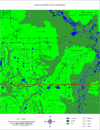
A DLG map illustrates cartographic features in the vector format and most are produced by the USGS. These maps can still contain detail such as bodies of water and such but for the most part they are a outline of the depicted geographic area. The DLG map above represents Tosohatchee Wildlife Management Area which is often referred to as having the largest stand of Cypress forest still left uncut in Florida.
No comments:
Post a Comment